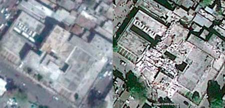
Google Earth Reveals the Devastation in Haiti
Google Earth has found yet another practical use – before and after pictures of natural disaster impacted areas. Akin to slowing down on the highway to get an eyeful of a wreck, people are viewing in droves. So while you are at it, send a little love their way with a donation to help the poor Haitians who have been devastated by Mother Nature. Your conscience will thank you.

Google responded to the devastating earthquake that hit Haiti earlier this week by working with satellite imagery company GeoEye to quickly make images of the destruction available in Google Earth and Google Maps. The images were taken at approximately 10:27 a.m. Eastern time on Wednesday, and could prove to be a helpful tool for aid organizations attempting to survey and assess the damage to Haiti’s infrastructure.

Comments are closed.